The Travels of a Journalistâ€â€ÂÂ68.-We go mule riding in Mexican border, dip our feet in Hot Springs’ water,and make camping super adventure
Posted on May 13th, 2011
By Shelton A. Gunaratne ƒÆ’-¡ƒ”š‚© 2011 Professor of mass communications emeritus at Minnesota State University Moorhead
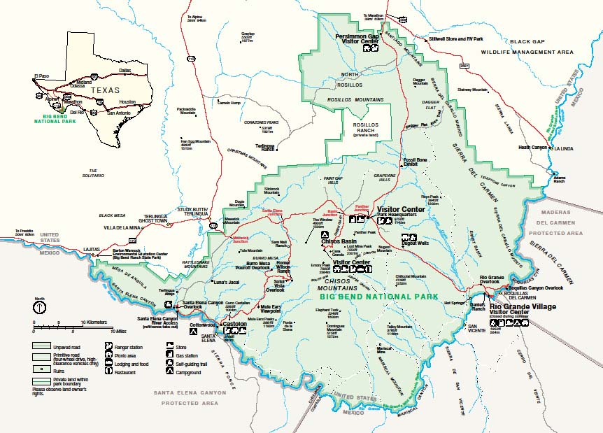
As I mentioned in Travels-67, we entered the Big Bend NP through the three-mile long Persimmon Gap, the parkƒÆ’‚¢ƒ¢-¡‚¬ƒ¢-¾‚¢s northern entrance/exit. Named for the Texas persimmon trees that grow in abundance in the nearby arroyos (desert washes), the gap has been a pass through the Santiago Mountains on the Comanche Trail, the Marathon-Boquillas stagecoach route, the Old Ore Road, and also a route used by the U.S. Army.
A few miles south of the gap is the Dog Canyon Trail, forking east and leading to the Nine Point primitive campground. The waters from the Nine Point Draw and the Bore Spring Draw have cut the gorge that created the Dog Canyon, now considered the dividing line between Santiago Mountains and Dead Horse Mountains to the south. The story goes that the Dog Canyon was so named by an early traveler who found a dog guarding an abandoned ox-drawn wagon in the canyon.
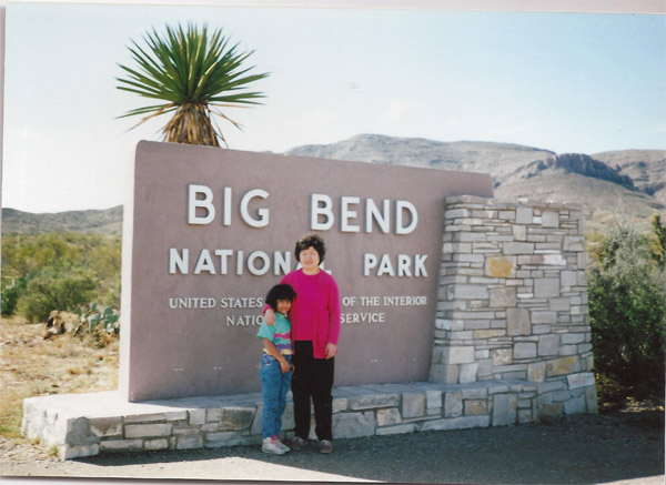
Daughter Carmel, 7, and wife Yoke-Sim at the entrance to the Big Bend NP (25 Nov. 1991).]
One lesson we learnt on the first day of our visit to the Big Bend was this: Heavy rains transformed the desert washes into muddy raging torrents. When the flood subsided, the water sank into the gravel and continued to flow underground. We saw it happening before our very eyes!
Figure 1: Big Bend National Park. We camped the first night at Rio Grande Village Campground, the second night at Cottonwood Campground, and the third night at Chisos Basin Campground. (Source: U.S. National Park Service).
Driving further south on Persimmon Gap Drive, we passed the Dagger Mountain, so named because of the Giant Daggers that grow along its slopes. We learned that the mountain took the shape of a dome or anticline when geological forces pushed up the molten rock under the limestone beds. We skipped the seven-mile improved auto trail that forks eastward to Dagger Flat and Sierra del Caballo Muerte. About two miles into the same trail lies the northern end of the Old Ore Road, which zigzags its way 25 miles to Rio Grande Village.
Then, we drove past Tornillo Flat, the expanse of flatlands on both sides of Tornillo Creek, the largest drainage in the park. Once covered with a solid growth of native grasses, this expanse has turned into one of the most barren areas of the park because of soil erosion caused by overgrazing. We learned that from our entry point at Persimmon Gap, we had ascended a long, gentle gravel road up to Tornillo Flat.
We, then, stopped at the Fossil Bones exhibit in the vicinity of Tornillo Creek Bridge. This was a display of bones imbedded in sandstone of early Eocene Age dating back to 50 million years. Among the bones were those of Coryphodon, an extinct mammal.
Yet further to the south was the Hannold Draw, named after Nina Hannold, who homesteaded a ranch in the vicinity but died of blood poisoning in 1911 at the age of 29.
Finally, we arrived at the Big Bend NP headquarters in Panther Junction (elevation 3,750 ft.) to pay for official admission to the park (currently $20 per car for one week) and to get advice from the visitorsƒÆ’‚¢ƒ¢-¡‚¬ƒ¢-¾‚¢ center. We walked the adjoining Panther Path, a self-guided nature trail that orients the visitor to desert plants.
Rio Grande Village
We had to travel another 20 miles southeast on the scenic drive to the Rio Grande Village, to get to the riparian site on the National Park Service campground we had reserved for our stay overnight. (The fee for camping was $5 compared to the current $14.) This drive offered us the chance to enjoy a variety of desert scenery, which became increasingly spectacular, as we got closer to MexicoƒÆ’‚¢ƒ¢-¡‚¬ƒ¢-¾‚¢s Sierra del Carmen, which took on a rosy glow at sunset.
On this drive, about 1.5 miles east of Panther Junction, is the so-called K-Bar ranch siteƒÆ’‚¢ƒ¢-¡‚¬ƒ¢¢”š¬‚the location of the Chihuahuan Desert Research Station. Less than a mile from the ranch house, built in 1927, is the K-Bar primitive campground.
About five miles southeast of Panther Junction, we passed the primitive gravel road that heads southwest to Nugent Mountain; then, turns south to Glen Spring, on the western side of Chilicotal Mountain (4,108 ft.). Less than a mile ahead on the scenic drive, we stopped at Dugout Wells (so named because the first home built there was dug into the ground to form a dugout shelter), where we walked along a short self-guiding loop named the Chihuahuan Desert Nature Trail.
Closer to the Rio Grande Village, just after passing the turnoff to Old Ore Road, we drove through a short tunnel and stopped at the Rio Grande Overlook to view Sierra del Carmen in its magnificent splendor.
Immediately thereafter, we reached the Rio Grande Village campground, where we set up our tent, cooked and ate our dinner, and curled into our sleeping bags hoping for a good nightƒÆ’‚¢ƒ¢-¡‚¬ƒ¢-¾‚¢s slumber. But severe cold caused us misery in the dead of night forcing us to wrap ourselves in our jackets.
Day 2 at Big Bend
Tuesday (26 Nov. 1991) morning, we woke up to the calls of coyotes. (I almost felt that the rangers had orchestrated these calls of their wild chums to clear the campgrounds early.) After eating breakfast at the camp in a riparian setting, we began to explore the Rio Grande Village and its surroundings until mid-afternoon.
Our exploration began with a walk through the one-quarter-mile Rio Grande Village Nature Trail in the southeastern corner of the campground. The trail provided a delightful introduction to the flora and fauna in the area.
Then, we explored the banks of Rio Grande just across the Mexican community of Ojo Caliente in Coahuila State. We learned that Rio Grande Village was abut 25 miles northeast of Mariscal Canyon, the location of Rio GrandeƒÆ’‚¢ƒ¢-¡‚¬ƒ¢-¾‚¢s ƒÆ’‚¢ƒ¢-¡‚¬ƒ…-big bend.ƒÆ’‚¢ƒ¢-¡‚¬ƒ”š‚ (We were short of time to drive 15 miles southwest on River Road East to Solis and then hike through Cross Canyon Trail and Mariscal Canyon Rim Trail to Talley to view the splendor of the massive gorge at the ƒÆ’‚¢ƒ¢-¡‚¬ƒ…-big bendƒÆ’‚¢ƒ¢-¡‚¬ƒ”š‚ itself.)
Known as Rio Bravo del Norte in Mexico, the Rio Grande flows from its headwaters near Alamosa, Colo., through New Mexico and down the Texas-Mexico border through Big Bend to Brownsville and the Gulf of Mexico. It offers spectacular views of high mountains, the desert floor, wild animals, beautiful sunrises and sunsets, breathtaking flora and fauna and just about everything.
We ambled to the visitorsƒÆ’‚¢ƒ¢-¡‚¬ƒ¢-¾‚¢ center to get advice on our travel plans and to watch a short documentary on the area. Thereafter, we took off five miles east on the Rio Grande Village Drive to the Boquillas Canyon Overlook so that we could get a view of the canyon before visiting it. The limestone cliffs we passed through were rampant with hechtia, a plant of the pineapple family.
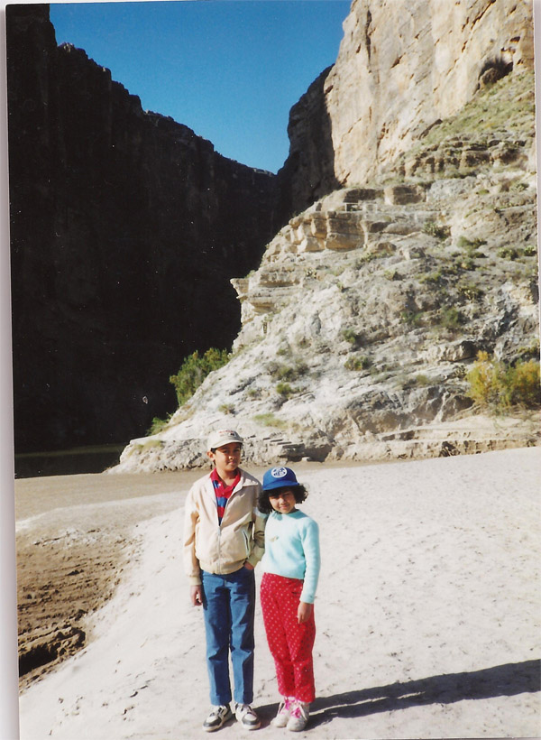
We reached the entrance to the 1.4-mile (round-trip) Boquillas Canyon Trail along the riverbank. The trail climbs over a low limestone hill and drops to the banks of the Rio Grande near some Indian mortar holes. We had great views of the river and mouth of Boquillas Canyon. We noted the 150-ft. cliffs on each side of the canyon.
Son Junius, 11, and daughter Carmel, 7, along the Boquillas Canyon Trail (26 Nov. 1991).]
The adventure of the day commenced after we reached the international crossing to the ƒÆ’‚¢ƒ¢-¡‚¬ƒ…-primitiveƒÆ’‚¢ƒ¢-¡‚¬ƒ”š‚ village of Boquillas del Carmen (next to Ojo Caliente) in the Mexican state of Coahuila.
Operated entirely by the Mexican villagers, it is an informal crossing at the end of a dirt road over a hill that descends to the river. You can cross over to Mexico by alerting the operators of the rowboats on the opposite riverbank. Soon, we received a boat ride to Boquillas del Carmen for a fare of $2 per adultƒÆ’‚¢ƒ¢-¡‚¬ƒ¢¢”š¬‚the cheapest fare we paid for landing in a foreign country! No passports or visas involved just like when I stepped on to Canada from the United States during our visit to the Voyageurs National Park in Minnesota in 1988 (see Travels-48).
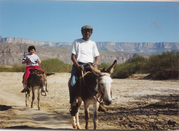
We could not refuse the localsƒÆ’‚¢ƒ¢-¡‚¬ƒ¢-¾‚¢ offer of renting us two mules (donkey-horse hybrids) at $3 each for the duration of our visit. Thus, we turned into ƒÆ’‚¢ƒ¢-¡‚¬ƒ…-Yankee doodles who went to town riding on their poniesƒÆ’‚¢ƒ¢-¡‚¬ƒ”š‚ to the utter delight of Carmel and Junius. In town, we ate a delicious authentic Mexican lunch comprising burritos, tacos and tamales downed with beer and CokeƒÆ’‚¢ƒ¢-¡‚¬ƒ¢¢”š¬‚all for $5. We rode the mules back to the river for our 2 p.m. return boat ride to Rio Grande Village in Big Bend NP.
ƒÆ’-¡ƒ”š‚ The author and wife Yoke-Sim riding their rented mules from the Mexican town of Boquillas del Carmen to the international crossing along Rio Bravo del Norte for the 2 p.m. rowboat ride to the United States (26 Nov. 1991).]
(Note: Wikipedia explains that until the 7/11 terrorist attack on the U.S., Boquillas del Carmen functioned as a small (300 resident) town that was primarily dependent on the Big Bend tourist trade, with visitors crossing the Rio Grande to visit the village’s bar, restaurant and taco stands. Tourism options included pony and donkey rentals, parties at Park Bar and overnight stays at a local bed and breakfast, The Buzzard’s Roost. All that ended in 2001. In 2011, however, the federal government announced its intention to re-open the Texas-Mexico border crossings.)
Before we left Rio Grande Village on our return journey to Panther Junction, we wanted to visit another landmark in the vicinity. So back on the scenic drive, about a mile west of the Tornillo Creek Bridge, we turned south into a two-mile gravel road that follows a rather rough wash through the limestone hills to a point overlooking the confluence of Tornillo Creek and the Rio Grande. J. O. Langford, who homesteaded here in 1908, built a house on the bluff above the spring to create a health resort using the springƒÆ’‚¢ƒ¢-¡‚¬ƒ¢-¾‚¢s natural hot water for baths. Langford sold the property to the state of Texas in 1942. We were in the famous Hot Springs. We gave into our natural instincts and dipped our hands and feet into the hot springs to enjoy the sensation.
We crossed the Big Bend NP from the southeast to the southwest via the park headquarters at Panther Junction and spent the rest of the afternoon exploring Ross Maxwell Scenic Drive. We camped overnight at the National Park ServiceƒÆ’‚¢ƒ¢-¡‚¬ƒ¢-¾‚¢s Cottonwood Campground adjacent to Castolon.
(To be continued)


May 15th, 2011 at 4:10 am
We really enjoyed reading this article. As always it was very well written and visually engaging which made us feel we were there too. Particularly liked the reference to “yankee doodles”-made us smile! Thank you for posting it and await the next in the series.