The Travels of a Journalistâ€â€ÂÂ69-We leave Big Bend National Park with many fond memories to spark our interest in digging more of Texas
Posted on May 20th, 2011
By Shelton A. Gunaratne ƒÆ’-¡ƒ”š‚© 2011 Professor of mass communications emeritus at Minnesota State University Moorhead
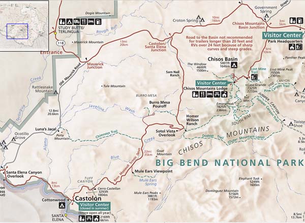
On our way to Cottonwood Campground in the Rio Grande floodplain Tuesday (26 Nov.) late afternoon, we focused on exploring the area along the Ross Maxwell Scenic Drive. Because we did not have adequate time Tuesday to explore all the tourist spots on this scenic drive, we spent much of Wednesday as well to cover the spots we missed. However, so as not to confuse the reader, I shall comment on the attractions we encountered in spatial order from north to south as if we covered everything on the forward journey to Cottonwood.
The 30-mile Ross Maxwell Scenic Drive, which follows a fault line along the eastern edge of Burro Mesa, starts at Castolon/Santa Elena Junction, about 13 miles west of Panther Junction. Burro Mesa, so named for the herd of wild burros (donkeys) that used it as their grazing ground, is a gently westward-sloping mesa standing high above the surrounding desert floor to the northwest of the Chisos Mountains. At its highest point the mesa reaches an elevation of 4,431ƒÆ’-¡ƒ”š‚ ft. The much slower erosion of the hard, igneous rocks crowning Burro Mesa in comparison to the softer rocks on the opposing side of the fault has over time down-dropped one side of the valley accommodating the fault line.
FIGURE 1: Western section of Big Bend National Park showing the route and landmarks between Cottonwood/Castolon and Chisos-Basin campgrounds.
Source: U.S. National Park Service.]
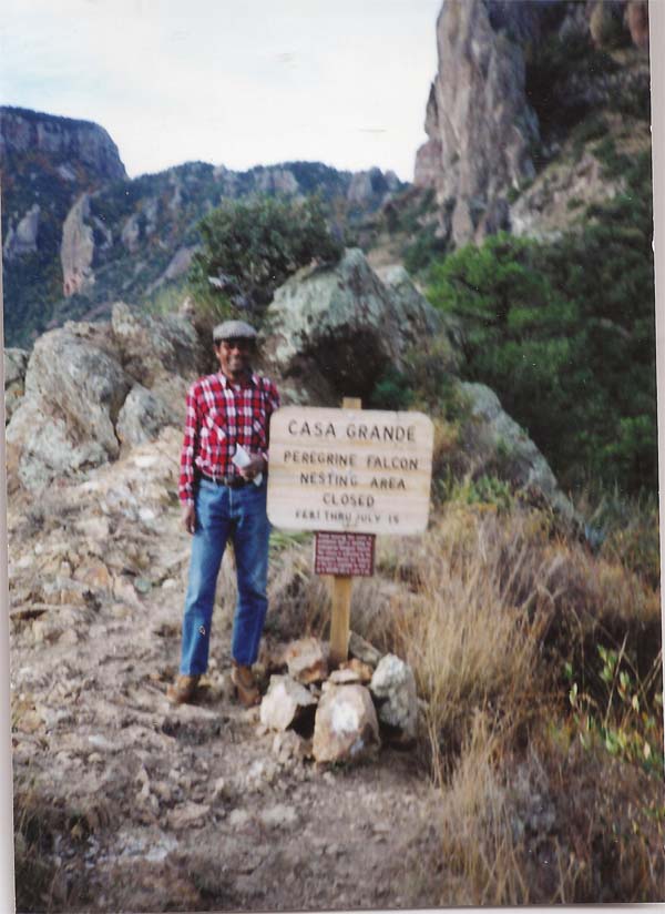
The Chisos Mountains, which form a great wall across the valley to the east, provided us with vistas of incredible rock formations as we drove south. ƒÆ’-¡ƒ”š‚ At one point, we looked through the igneous wall to see Casa Grande (5,401 ft.) framed by the Window (4,600 ft.). Evidence shows that Oak Creek, which flowed down the drainage below the Window, was a clear stream that created the best grassland in West Texas in the 1880s. Greedy ranchers brought thousands of cattle, sheep and goats to this area that overgrazing caused severe erosion to the extent that the creek stopped flowing. Oak Creek today is a far cry from what it used to be.
Picture 1 The author with Casa Grande in the background (28 Nov. 1991).]
Not too far away, a short path forking to the west takes the visitor to the abandoned Old Sam Nail Ranch house along Cottonwood Creek that Sam Nail and his younger brother Jim built in 1916. The house had a concrete floor, a viga and cane ceiling and a corrugated metal roof. Close to the Nail ranch are several rock outcroppings that resemble rock walls or dikes. We crossed one of these dikes that ran up the hillside more than a mile to the east.
Next, at the parking lot on the highest point of the drive, the Homer Wilson (Blue Creek) Canyon Overlook provides a good view of the ƒÆ’‚¢ƒ¢-¡‚¬ƒ…-red rockƒÆ’‚¢ƒ¢-¡‚¬ƒ”š‚ upper Blue Creek Canyon and the restored bunkhouse of the defunct Homer Wilson Ranch, one of the largest in the region prior to the establishment of the park 1933-1944. Blue Creek is the main drainage area west from the high Chisos Mountains. A short trail leads down to the ranch buildings and connects with the Blue Creek Canyon and Dodson trails. Emory Peak (7,832 ft.), the highest point of the Big Bend NP, lying majestically to the northeast of the ranch, seemed to exhort hikers to visit its peak.
A short distance away is the Sotol Vista Overlook. The park pundits advice the hoi polloi not to bypass it because the ƒÆ’‚¢ƒ¢-¡‚¬ƒ…-view from the end of this short road is one of the best in the park, and the first point along the Castolon Road from which you can see Santa Elena CanyonƒÆ’‚¢ƒ¢-¡‚¬ƒ”š‚ƒÆ’‚¢ƒ¢-¡‚¬ƒ¢¢”š¬‚still 14 straight miles to the southwest. Sotol Vista is so named because of the heavy growth of sotolsƒÆ’‚¢ƒ¢-¡‚¬ƒ¢¢”š¬‚large bright green plants with sharp teeth along the margins of the leavesƒÆ’‚¢ƒ¢-¡‚¬ƒ¢¢”š¬‚that cover the Sotol Vista ridge.
Those who want to see the Burro Mesa Pouroff can turn west on the 1.5-mile side road that runs north to the base of the colorful cliffs of Burro Mesa. There, they can hike the one-half mile trail into a hidden box canyon to a high pouroff or dry (water) fall. A variety of desert wash plants and magnificent geology are the other attractions.
Closer to the southern end of the scenic drive, we stopped in the parking area at Mule Ears Viewpoint to see the landmark Mule Ears Peaks formed by dikes that erosion has sculptured into the shape of the ears of a mule. About a mile to the northwest of the peaks is the Mule Ears Spring. As you proceed further south, another landmark, Tuff Canyon, appears on the west side of the scenic drive. (Park pundits opine that these two landmarks are worthy of in-depth exploration.) Tuff Canyon was carved out of soft volcanic tuff (compressed ash). Travelers can easily observe the deep and narrow canyon from two viewing platforms. They can also enter and hike through the gorge.
We reached the floodplain of Rio Grande at the southern end of the scenic drive and turned west to Cottonwood Campground, adjacent to Old Castolon, the location of the parkƒÆ’‚¢ƒ¢-¡‚¬ƒ¢-¾‚¢s oldest building used from 1900-1924. We were in the Castolon Historic District. Castolon, originally established as a cavalry camp, later served as the headquarters of the La Harmonia Co. At the campground, we ate a delightful dinner at Campsite 18, where we spent another riparian night.
Picture 2:The author, his wife Yoke-Sim and their daughter Carmel in the ƒÆ’‚¢ƒ¢-¡‚¬ƒ…-echo chamberƒÆ’‚¢ƒ¢-¡‚¬ƒ”š‚ of the Santa Elena Canyon (26 Nov. 1991),]
Day 3 in Big Bend
Wednesday (27 Nov), soon after breakfast, we left the campground and drove eight miles west along the Rio Grande floodplain to the Santa Elena Canyon Overlook, the starting point of 1.7-mile Santa Elena Canyon Nature Trail, ƒÆ’‚¢ƒ¢-¡‚¬ƒ…-one of the grandest spectacles in the park.ƒÆ’‚¢ƒ¢-¡‚¬ƒ”š‚ After viewing the mammoth (1,500 ft.) cliffs of the spectacular canyon from the overlook, we waded across the Terlingua Creek to reach the nature trail, which climbs several short switchbacks and then gradually descends along the banks of the Rio Grande/Rio Bravo del Norte. Lush riparian vegetation and towering vertical cliffs of solid limestone surround the hikers. The thrill of the day for me was when I coo-eed Aussie-style in the middle of the trail and I heard the canyon returning my echo loud and clear!
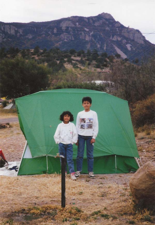
Picture 3 Carmel, 7, and Junius, 11, at campsite 18 of Cottonwood Campground, where we set up our tent to stay overnight on Tuesday 26 Nov. 1991.]
When we backtracked our way on the floodplain to Cottonwood, we found hardly any evidence that this expanse of flatland was a center of cotton farming from 1921 until the record flood of 1974 that destroyed the farmland and deposited the heavy ginning machinery at the bottom of the river.ƒÆ’-¡ƒ”š‚ The foundation of the gin is visible adjacent to the Cottonwood Campground.
From Cottonwood, we drove a mile southeast to Rio Grande to see the crossover point to the Mexican village of Ejido del Santa Elena. Before 7/11, Mexicans from this village in Chihuahua State had crossed the border freely to shop at Castolon. For the sake of history, we too stopped at La Harmonia Co. store to buy some groceries for camping. Then, we resumed our return journey north on Ross Maxwell Scenic Drive after a pause to look at Cerro Castellan (3,293 ft.). I have already mentioned the landmarks along this drive that we explored both on this trip and on the day before. We ate lunch at Mule Ears Overlook.
At the Castolon/Santa Elena Junction, we turned northeast on Maverick Drive and then turned southwest into the seven-mile Basin Drive at Chisos Mountains Basin Junction to get to Chisos Basin Campground. The Basin Drive descends around a series of sharp curves to some 5,400 ft. in the Chisos Basin, where we set up our tent on campsite 34, which became our ƒÆ’‚¢ƒ¢-¡‚¬ƒ…-homeƒÆ’‚¢ƒ¢-¡‚¬ƒ”š‚ for our final night at Big Ben NP. The Chisos Mountains surrounded us. I felt that Casa Grande (7,325 ft.) and Emory Peak (7,825 ft.) just to the south of the campground, were staring at us.
Later, all of us went to the Upper Basin to hike on two trails: the 0.3-mile Window View Trail and the 1.6-mile Chisos Basin Loop Trail. After dark, we used a torch to guide us along a trail to the Chisos Mountains Lodge to enjoy its facilities for a short while. But the kids complained about the walk in the dark.
Gracias, Big Bend
We said goodbye to Big Bend on Thanksgiving Thursday (28 Nov.). But we wanted to do another hike before we left. We decided to skip the five-hour hike to the summit of Emory Peak on the Pinnacle Trail in favor of hiking the 4.6-mile (round-trip) Lost Mine Trail, ƒÆ’‚¢ƒ¢-¡‚¬ƒ…-one of the best trails in the park.ƒÆ’‚¢ƒ¢-¡‚¬ƒ”š‚ The trail begins at the parking area on the south side of the road just west of the Panther Pass (5,679 ft.). It offers a self-guided tour of the parkƒÆ’‚¢ƒ¢-¡‚¬ƒ¢-¾‚¢s flora, fauna and scenery that increased our knowledge of desert plants, animals and geology exponentially over the two hours and 40 minutes we took to complete the hike. Carmel and Junius enjoyed this experience of self-learning. However, we did not make it to the Lost Mine Peak (7,550 ft.), the second highest peak in the park that looks like a jagged ridge in the skyline.
We left Panther Pass at 11.30 a.m., and said goodbye to our newfound amigo Big Bend NP at Maverick Junction, the parkƒÆ’‚¢ƒ¢-¡‚¬ƒ¢-¾‚¢s western exit/entry point. We realized that three days was not adequate to see all the numerous features of the park. For example, we had to skip the many attractions along Maverick Drive (Government Hills, Tule Mountain, etc.) and Old Maverick Drive (Old Canyon Outlook, Terlingua Abaja, etc.).
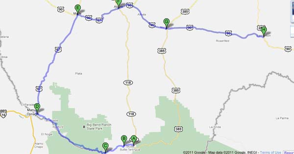
Our exit route to Sanderson, TexasƒÆ’‚¢ƒ¢-¡‚¬ƒ¢¢”š¬‚our destination for the dayƒÆ’‚¢ƒ¢-¡‚¬ƒ¢¢”š¬‚circled the Big Bend NP. This deliberately chosen longer route, which more than doubled the distance to our destination than through the shorter route via SR 118 (see Figure 2), reminded me of the Sinhala allusion ƒÆ’‚¢ƒ¢-¡‚¬ƒ…-Parangia Kotte giya wagai.ƒÆ’‚¢ƒ¢-¡‚¬ƒ”š‚
We stopped in Lajitas for lunch. Then, we proceeded northwest along the Rio Grande to Presidio (pop, 4,167), where we crossed the river for a brief visit to the Mexican town of Manuel Ojinaga (pop. 20,744), the administrative seat of the municipality of Ojinaga. We had to pay a toll of $2 to re-cross the Presidio-Ojinaga International Bridge. Then, we drove northeast to Marfa; and east to Alpine and Marathon, where we arrived at 6 p.m. The historic Gauge Hotel in Marathon enticed us to celebrate Thanksgiving with a grand dinner, which cost us $40.
Finally, off we drove to Sanderson, 54 miles further east, where we spent the night at the Desert Air Motel.
Figure 2: Our exit route from Big Bend National Park to Sanderson, Texas (239 miles) on Thanksgiving Day 1991:
A=Study Butte (west of Maverick Junction, Big Bend NP); B=Terlingua; C=Lajitas; D=Presidio (opposite Mexican city of Manuel Ojinaga in Chihuahua); E=Marfa; F=Alpine; G=Marathon; H=Sanderson.
(Next: San Antonio)
