The Demarcation of Provinces in Ceylon under British Rule
Posted on September 8th, 2020
Michael Roberts Courtesy Thuppahi’s Blog
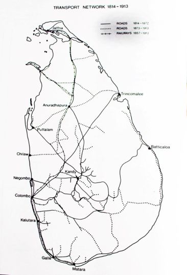
After the British imperial power consolidated its conquest of the island of Ceylon in 1815 and 1817/18, they began to ‘stitch the island together by commencing a road building programme; while the Colebrooke Cameron Commission which visited the island recommended the creation of five Provinces.”

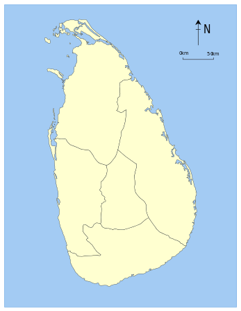
As the Wikipedia account notes,[i] accordingly, on 1 October 1833 five provinces under one administration came into being”:
- Central Province– composed of the central Kandyan provinces.
- Eastern Province– composed of the maritime districts of Batticaloa and Trincomalee, and the Kandyan provinces of Bintenna and Tamankaduwa.
- Northern Province– composed of the maritime districts of Jaffna, Mannar and Vanni, and the Kandyan province of Nuwara Kalawiya.
- Southern Province– composed of the maritime districts of Galle, Hambantota, Matara and Tangalle, and the Kandyan provinces of Lower Uva, Saffragam and Wellassa.
- Western Province– composed of the maritime districts of Colombo, Chilaw and Puttalam, and the Kandyan provinces of Three Korales, Four Korales, Seven Korales and Lower Bulathgama.
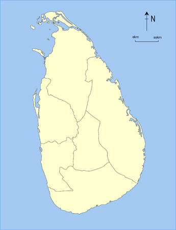
However, over the next fifty years four additional provinces were created, taking the total number to nine:
- North Western Provincewas created in 1845 from northern Western Province (districts of Chilaw, Puttalam and Seven Korales)
- North Central Provincewas created in 1873 from southern Northern Province (district of Nuwara Kalawiya) and north-western Eastern Province (district of Tamankaduwa).
- Uva Provincewas created in 1886 from parts of Central Province, Eastern Province (district of Bintenna) and Southern Province (district of Wellassa).
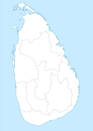
- Sabaragamuwa Provincewas created in 1889.

1833-45

1845-73

1873-86

1886-1889

1889-Present
ADDENDUM from https://en.wikipedia.org/wiki/Provinces_of_Sri_Lanka
The number of provinces remained static until September 1988 when, in accordance with the Indo-Lanka Accord, President Jayewardene issued proclamations enabling the Northern and Eastern Provinces to be one administrative unit administered by one elected Council, creating the North Eastern Province. The proclamations were only meant to be a temporary measure until a referendum was held in the Eastern Province on a permanent merger between the two provinces. However, the referendum was never held and successive Sri Lankan presidents issued proclamations annually extending the life of the temporary” entity. The merger was bitterly opposed by Sri Lankan nationalists. On 14 July 2006, after a long campaign against the merger, the JVP filed three separate petitions with the Supreme Court of Sri Lanka requesting a separate Provincial Council for the East. On 16 October 2006 the Supreme Court ruled that the proclamations issued by President Jayewardene were null and void and had no legal effect. The North-East Province was formally de-merged into the Northern and Eastern provinces on 1 Janaury 2007.
************
END NOTES
[i] See https://en.wikipedia.org/wiki/Provinces_of_Sri_Lanka. Note that in some Wikipedia accounts the details are erroneous [for eg Uva said to be created in 1993).
September 9th, 2020 at 4:57 am
Even whole of London is divided into many boroughs for admistrative and political reason. Colonials united the country.